Contents
Below you will find a few examples of notable earthquakes that impacted Costa Rica.
The 1991 Limon Earthquake
 This 7.7 Mw earthquake had its epicenter in Pandora, Valle La Estrella, which is in Costa Rica’s Limon Province, on the Caribbean side of the country. It is the strongest earthquake ever recorded in Costa Rica.
Despite having its epicenter in Costa Rica, a majority of the fatalities were reported from Panama, where constructions in the Bocas del Toro Province sustained a lot of damage. The earthquakes caused 48 deaths in Costa Rica and 79 in Panama.
Epicenter coordinates: 9.685°N 83.073°W.
Earthquake depth: 10 km
Mercalli intensity: IX (violent)
The earthquake took place on 22 April, at 15:57 in the afternoon local Costa Rican time (21:57 UTC).
After the quake, a circa 3 meter tall tsunami was reported.
Damage in Costa Rica
Reported deaths: 48
Reported injuries: 109
Number of reported homeless: 7,439 people
Within the epicentral area, some zones experienced soil liquefaction. This is when previously solid soil starts behaving like a liquid in response to an applied stress, such as an earthquake.
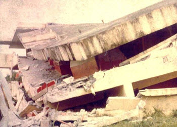
Many buildings collapsed in Limón, including several hotels.
Off the Costa Rican coast, a waterfront uplift exposed coral and sand bluffs.
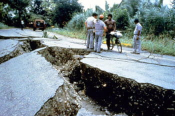
The border town Sixaola was cut off from the port town Puerto Limón, as the earthquake destroyed roads and bridges between the two towns. In the aftermath of the quake, helicopters became an important mode of transport for aid needing to reach cut off zones in the epicentral region.
Fortunately, the bridge connecting Sixaola with Costa Rica was not destroyed.
Damage in Panama
Examples of places that sustained serious damage: Almirante, Changuinola, Guabito, Isla Colon
Reported deaths: 79
Reported injuries: 454
Destroyed buildings: 866
Approximately 2,400 people lost their homes.
For more information, visit our page about earthquakes in Panama.
The 2002 Burica Earthquake
This 6.5 Mw earthquake had its epicenter in Panama, but caused in damage in Costa Rica as well. No deaths were reported from any of the countries and the number of injuries were also low on both sides of the border.
The earthquake occurred on 31 July at 00:16 UTC time.
The epicenter was off the southeastern coast of Panama’s Burica Peninsula, not far from the Costa Rican border. Coordinates: 7.91°N 82.75°W.
For more information, visit our page about earthquakes in Panama.
The 2003 Puerto Armuelles Earthquake
 This 6.5 Mw earthquake had its epicenter in Panama, but buildings were damaged in Costa Rica as well. Only two deaths were reported, and none of those occurred in Costa Rica.
The epicenter was at 8.416°N 82.824°W, which is roughly 7 km east of Puerto Armuelles in Panama.
The quake had a maximal intensity of VIII (severe) on the Mercalli scale in Finca Naranjo, Costa Rica. In Puerto Armuelles, the intensity was just VII.
The earthquake occurred at 25 December 07:11 UTC time.
For more information, visit our page about earthquakes in Panama.
2009 Cinchona earthquake
 This 6.1 Mw earthquake took place on 8 January 19:21 UTC time. In Costa Rica, the local time was 13:21 in the afternoon.
The epicenter was located in northern Costa Rica (10.23°N 84.22°W), roughly 30 km north-northwest of the capital San José.
Depth: 12.5 km
Mercalli intensity: VII (very strong).
Damage
34 deaths were reported, plus 91 injuries. Of the dead, at least three were children. A majority of the 34 deaths were caused by a landslide near the La Paz waterfall by the Poás Volcano.
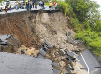
A lot of buildings and roads were seriously damaged, and several bridges became unusable. Two villages were cut off by the earthquake.
One example of heavily hit location was the town Chinchona, where virtual all buildings sustained serious damage.
All in all, over 40 communities were seriously impacted.
Aftermath
452 people, including 369 tourists, were evacuated in helicopters.
Costa Rica’s National Emergency Commission requested private helicopters to help, and the USA and Colombia sent helicopters from abroad.
The Costa Rican Red Cross dispatched roughly 400 people to help with the recovery work.
On January 12, Costa Rica’s president declared a five day long period of national grieving.
The 2012 Costa Rica Earthquake
 With a magnitude of 7.6 Mw, this was one of the strongest earthquakes ever recorded in Costa Rica. It occurred on 5 September at 08:42 local Costa Rican time (14:42 UTC).
The epicenter was at 9.996°N 85.318°W on the Nicoya Peninsula, roughly 11 km east-southeast of the city Nicoya. The same area had experienced a M7.7 earthquake in 1950, but had then been left relatively undisturbed until the 2012 quake.
The 2012 Costa Rica earthquake had a depth of circa 40 km, and reached a Mercalli intensity of X (extreme) in Nosara, near the epicenter. The shake was felt throughout Costa Rica, and also in Panama to the south and Nicaragua and El Salvador to the north – even though El Salvador doesn’t even border to Costa Rica.
Damage
Examples of places were buildings were seriously damaged or destroyed:
- The canton Nicoya on the Nicoya Peninsula, in the Guanacaste Province.
- The canton Hojancha in the midsection of the Nicoya Peninsula, in the Guanacaste Province.
- The canton Nandayure on the Nicoya Peninsula, in the Guancaste Province.
- The canton of Santa Cruz on the Nicoya Peninsula, in the Guancaste Province.
- The canton of Carrillo in the Guanacaste Province, where cracks were found at the dyke that protects the city Filadelfia from the Tempisque River.
- In the Puntarenas Province, the Hospital Monseñor Sanabria building was damaged and had to be partially closed off.
- Some damage reports came from as far away as the capital San José, where some buildings suffered from broken windows and cracked walls.
Circa 55,000 people in the provinces Puntarenas and Guanacaste had to go without running water due to earthquake damage.
Some parts of the Nicoya Peninsula, and also the Chira Island, suffered from black outs.
In some places near the epicenter, both GSM and 3G services suffered from interruptions.
Aftermath
The earthquake occurred at 08:42 local time, and as a security measure the school children in affected areas where sent home for the rest of the day.
The Costa Rican Red Cross dispatched over 200 people in emergency teams to the impacted areas.
Eventually, the Ministry of Public Education announced that over 50 schools needed to be demolished and rebuilt.
One of the largest aftershocks was a 5.7 magnitude one on that occurred on 8 September. It had its epicenter located roughly 13 km southeast of Playa Samara.
The 6.6 magnitude earthquake that happened on 24 October at 00:45 UTC is sometimes referred to as an aftershock to the 5 September quake. It had its epicenter near the town of Hojancha on the Nicoya Peninsula.
Aftermath in Nicaragua
Directly after the earthquake on 5 September, Nicaraguan authorities increased their monitoring of Nicaragua’s active volcanoes since they feared that the strong quake could have got a reaction going that would ultimately lead to one or more eruptions. On 8 September, San Cristóbal – Nicaragua’s highest volcano – erupted, prompting the evacuation of roughly 3,000 people from nearby communities. The ash cloud reached a height of 5,000 meters.
2017 Costa Rica earthquake
This 6.5 magnitude earthquake had it’s epicenter at 9.526°N 84.505°W, roughly 16 km southeast of Jacó on Costa Rica’s Pacific side. It reached a max intensity of VIII (severe) on the Mercalli scale.
It occurred on 13 November at 02:28 UTC time, but in Costa Rica it was still 20:28 local time on the evening of 12 November.
The earthquake, which had a depth of 19.8 km, was felt throughout Costa Rica, and also in parts of Panama and Nicaragua.
Damage
3 deaths reported