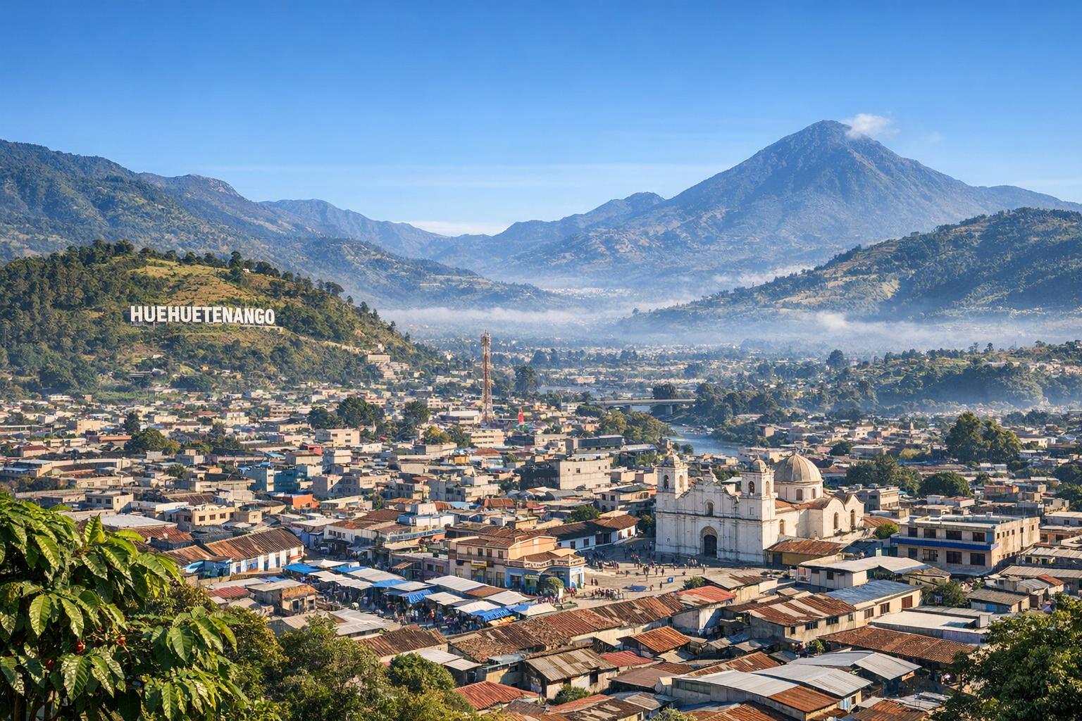
Huehuetenango: An Overview
Huehuetenango, often referred to simply as “Huehue,” is one of the 22 departments of Guatemala, located in the western highlands along the border with Mexico. Its geographic position has shaped patterns of migration, commerce, and cultural exchange for centuries, making it a region where local traditions and cross-border influences coexist. The department covers a large area relative to others in Guatemala and includes a combination of remote rural communities and modest urban centers, with the departmental capital also named Huehuetenango serving as an administrative and commercial hub.
The population is marked by a high proportion of indigenous peoples, many of whom maintain distinct languages, dress, and community structures. Unlike more urbanized areas of the country, Huehuetenango reflects a continuity of historical identity that is closely tied to land, agriculture, and communal organization. Despite its cultural richness, the region faces ongoing challenges related to infrastructure, economic development, and access to services, which shape daily life and long-term development strategies.
Geography and Climate
Huehuetenango’s landscape is defined by dramatic elevation changes and rugged terrain. The Sierra de los Cuchumatanes, the highest non-volcanic mountain range in Central America, dominates the northern and central portions of the department. Elevations in this range can exceed 3,800 meters, creating conditions that are distinct from the volcanic chains found elsewhere in Guatemala.
This topographical variation results in multiple microclimates within relatively short distances. Highland areas generally experience cool temperatures, with occasional frost in the highest elevations, while lower valleys and northern zones display warmer, more humid conditions. Rainfall patterns are also uneven, with a defined wet season that supports agricultural cycles and a dry season that can stress water availability in certain communities.
Rivers and smaller water systems run through the department, contributing to both agriculture and local ecosystems. However, the steep terrain can complicate transportation and infrastructure development, often isolating smaller communities and influencing patterns of settlement.
Natural Attractions
Huehuetenango’s natural environment is one of its defining features. The Sierra de los Cuchumatanes offers extensive trekking routes that pass through grasslands, cloud forests, and high-altitude plateaus. These environments are home to a range of plant and animal species, some of which are endemic to the region due to its ecological isolation.
Laguna de Magdalena is another notable site, valued for its still waters and surrounding vegetation. It serves both as a local recreational area and a site of cultural importance for nearby communities. Other lesser-known natural areas include caves, river valleys, and forest reserves that have begun to attract eco-tourism initiatives.
Environmental management remains an important consideration, as increasing population pressure and agricultural expansion can lead to deforestation and soil erosion. Conservation efforts often involve collaboration between local communities and regional organizations seeking to balance economic activity with environmental protection.
Seismic Activity and Earthquake Impact
Huehuetenango lies within a seismically active region due to the interaction of tectonic plates along the western edge of Central America. Although it is not located directly on the most active fault lines compared to southern Guatemala, the department has experienced the effects of major regional earthquakes over time.
One of the most significant events affecting the broader region was the 1976 Guatemala earthquake, which had a magnitude of 7.5. While the epicenter was located in the central highlands, the seismic waves caused structural damage in Huehuetenango, particularly in older buildings constructed with adobe and other traditional materials. Many rural homes suffered cracking or collapse, highlighting vulnerabilities in construction practices.
More recent seismic events, including moderate earthquakes originating near the Mexico-Guatemala border, have also been felt in Huehuetenango. These events tend to cause localized damage, especially in mountainous areas where landslides can be triggered. The steep slopes of the Cuchumatanes increase the likelihood of such secondary hazards, which can block roads and disrupt transportation networks.
In response, there has been a gradual shift toward more resilient building techniques, including reinforced masonry and improved planning standards. However, implementation varies widely, particularly in remote areas where access to modern materials is limited. Public awareness campaigns and disaster preparedness programs have expanded in recent years, often supported by national agencies and international organizations such as CONRED, Guatemala’s disaster management authority.
Culture and Heritage
Huehuetenango is one of the most culturally diverse departments in Guatemala, with multiple indigenous groups maintaining distinct identities. Among the most prominent are the Mam, Q’anjob’al, Chuj, Akateko, and Popti’ (Jakalteko) peoples. Each group has its own language, many of which are still widely spoken in daily life alongside Spanish.
Traditional clothing, or traje, varies significantly between municipalities and often signals community affiliation. These garments are typically woven by hand and incorporate patterns that reflect historical symbolism and local identity. Markets throughout the department serve as important cultural and economic centers where textiles, ceramics, and agricultural products are exchanged.
Festivals and religious practices blend pre-Columbian traditions with Catholic influences introduced during the colonial period. Community celebrations often include music, dance, and ceremonial events tied to agricultural cycles or patron saints. These traditions continue to play a central role in maintaining social cohesion and cultural continuity.
Historical Significance
The region that is now Huehuetenango was inhabited long before Spanish colonization, with evidence of organized settlements dating back to the Classic and Postclassic periods of Mayan civilization. One of the most important archaeological sites in the department is Zaculeu, located near the departmental capital.
Zaculeu was a fortified city associated with the Mam people and remained occupied until the Spanish conquest in the 16th century. The site features plazas, pyramidal structures, and defensive walls, reflecting both political organization and military strategy. Its preservation has made it a key location for understanding regional history.
Following colonization, Huehuetenango became part of broader administrative systems imposed by Spanish authorities. Over time, indigenous communities adapted while preserving many aspects of their social structures. Historical patterns of land distribution and governance continue to influence contemporary issues, particularly in rural areas.
Economic Aspects
The economy of Huehuetenango is largely based on agriculture, with small-scale farming forming the backbone of rural livelihoods. Maize and beans are staple crops, often grown for subsistence rather than commercial sale. In addition, the department has gained international recognition for its coffee production.
Huehuetenango coffee is cultivated at high altitudes, often above 1,500 meters, where cooler temperatures and volcanic soils contribute to slow bean development. This process enhances flavor complexity, making the coffee highly valued in specialty markets. Many farms remain small and family-operated, though cooperatives play an important role in processing and export.
Remittances also contribute significantly to the local economy. A considerable number of residents have migrated to other parts of Guatemala or to countries such as the United States, sending money back to support families and community projects. While this provides financial stability for some households, it also reflects limited local employment opportunities.
Infrastructure development, including road improvements and access to electricity, has expanded gradually but unevenly. Remote areas still experience limited connectivity, affecting access to education, healthcare, and markets.
Tourism Development
Tourism in Huehuetenango remains less developed compared to other regions of Guatemala, which has allowed it to retain much of its traditional character. Efforts to promote tourism often focus on sustainability and cultural respect, encouraging visitors to engage with local communities in meaningful ways.
Eco-tourism initiatives highlight trekking in the Cuchumatanes, visits to natural landmarks, and exploration of rural landscapes. Cultural tourism includes guided visits to markets, participation in local festivals, and educational experiences related to traditional weaving and agriculture.
Infrastructure for tourism, such as accommodations and transportation services, is improving gradually. However, development is often cautious to avoid disrupting community life or damaging natural resources. Organizations and local authorities continue to explore ways to balance economic benefits with cultural and environmental preservation. More travel information and resources can be found through Visit Guatemala.
Conclusion
Huehuetenango represents a complex and multifaceted region where geography, culture, and history intersect. Its mountainous terrain and varied climate shape both daily life and economic activity, while its indigenous communities maintain traditions that have persisted over centuries. The department’s exposure to seismic activity adds another dimension to its development, influencing construction practices and disaster preparedness efforts.
Although challenges related to infrastructure and economic opportunities remain, Huehuetenango continues to adapt while preserving its distinct identity. Its combination of natural landscapes, historical sites, and living cultural traditions offers insight into the broader dynamics of Guatemala’s western highlands.